Showing posts with label road trip. Show all posts

Friday, July 15, 2011

Looking For Chiloquin

My son Shay is in a town over the mountains, Grants Pass, and he wanted a picture or two to show his friends there his hometown. So today I had time and went rambling through our hills to get the perfect shot.


Shay ... As you can see from the picture above I got sidetracked yet again. I went down a positively nasty rutted out road and ended up at another section of Modoc Rim. Here is Klamath Lake Looking Klamath Falls way.


To try to make up for it, here is a shot from the 4th of July parade.


Ok ... I did make it to the power lines on the other side of the river, an area I'm sure you are used to. Its the best I could do. I was to tuckered out from hiking the cliffs on Modoc Rim with Charlie dog. Perhaps I'll get the perfect shot next time ok? lol

Sunday, June 19, 2011

Day 10: Living History Day Collier State Park

Today, the last day before I go back to school, Melissa took me to Living History Day at Collier Park. Outside of Crater Lake National Park, this is probably the most 'famous' place in this area. This is a big event with people dressing in period costumes to celebrate to logging past. Below is a photo of Spring Creek which runs through the park before slamming into the Williamson River.


Below is a 1912 steam engine that was used to haul logs. "It's even older than you Dad!" Thanks Hannah ....


Hannah getting cozy with a beaver. This is Oregon after all!


One more shot of Spring Creek. It was a fun day. Now to begin thinking about school ...


Saturday, June 18, 2011

Day 9: Klamath Marsh National Wildlife Refuge


This wasn't the best of days out taking pictures and all; factor in I'm getting physically tired after nine straight days of hiking around .... But this afternoon I packed up Charlie dog and out we went to the Klamath Marsh Refuge.


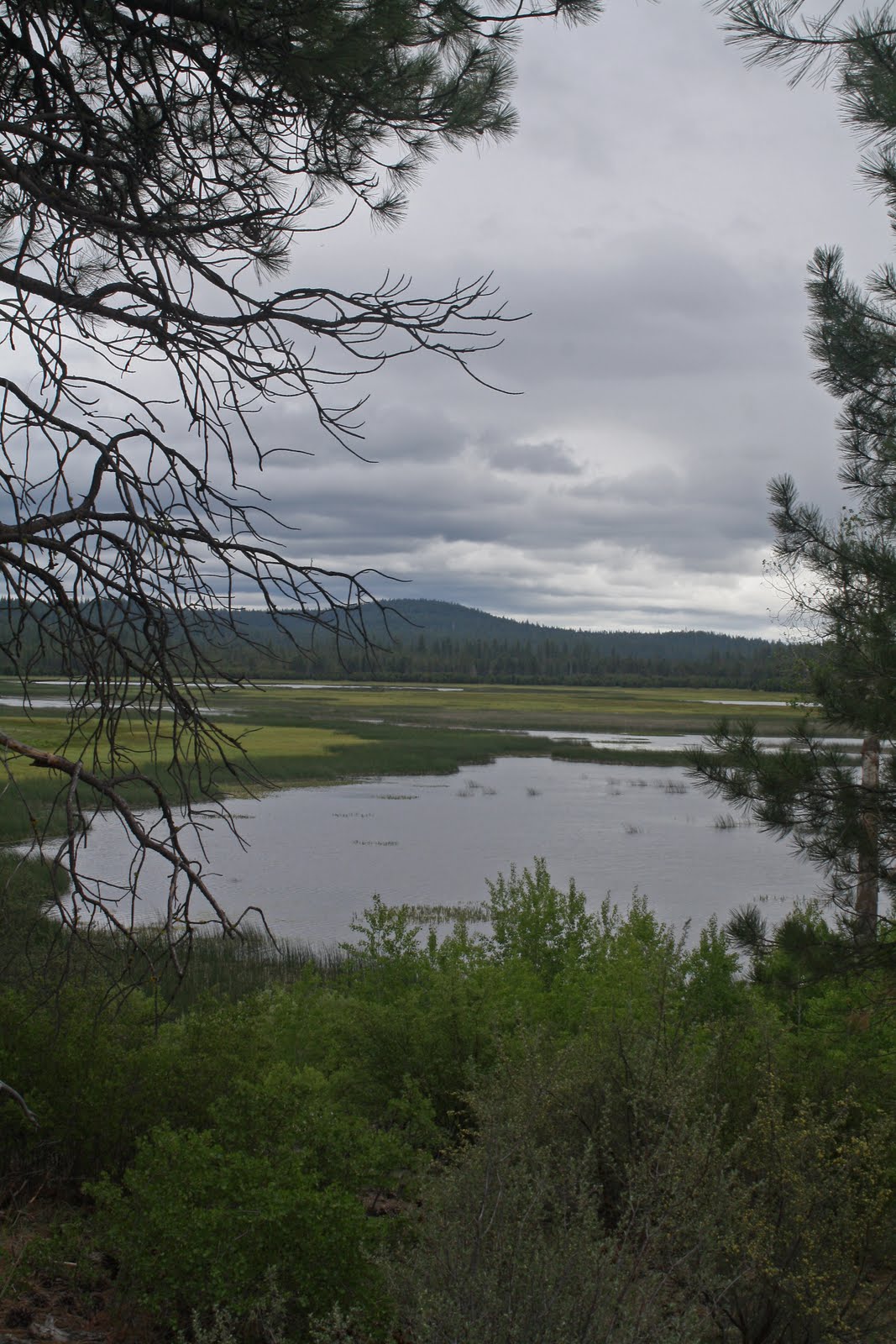
The pictures above and below is of the Refuge. Even with the clouds and wind the birds were out all over the place! I even found a cool camping spot I must check out further another day!


On the way home we passed through Wilson Flat, A great name for a place I must say. ;-) Just one day left until school starts back up ... A trip to Collier for Fathers Day is in order, thanks to Melissa and Hannah.

Friday, June 17, 2011

Day 8: Back to the Gorge

The Williamson River Gorge is a favorite place of mine and this was my first trip in there for the year. It was a great morning for a hike; bright and sunny with calm winds for those reflection shots! The picture below is of a favorite stopping point around the first bend.


There are several strange rock formations such as the one below in the canyon.


This picture I threw in for fun. Since I usually get out with crazy Charlie dog, I don't often get to take pictures of things that fly. Here is a rare exception, although from a distance.

Day 7: Fort Creek

Today we took a short jaunt to Fort Creek. Another one of those 'only locals know about' getaway. The lighting was a bit harsh for taking pictures but I gave it a shot anyway.


Below is looking down the creek as it makes its way to the Wood River, then Agency lake. Above is Reservation Spring which is the source of the creek. Crystal clear water bubbles up, and around it as the creek pretty much just flows out of the mountain.


I don't know the name of theses flowers but the pop up here and there especially in drier places. I wouldn't know why a person can't help themselves not to smile when they see them!

Thursday, June 16, 2011

Day 6: Modoc Rim


The adventure this time was to take a rutted out dirt road through woods and meadows to Modoc Rim which overlooks Klamath Lake on the East high above Highway 97. I could see someone went ahead of me and they got stuck in the mud twice. The second time they were stuck so bad I decided to park the Zuzu and walk the rest of the way about a mile or so. When I finally got there, lo and behold I saw a mud caked Marty the mailman and a friend! Naturally we all wondered why each of us were up there in that extremely remote area! It goes to show that you just never know who you might meet and where!

The picture above is the view from the Rim looking southwest towards Modoc Point. The one below was shot looking directly west at Mt. McLoughlin and the Oregon Cascades.


Which way to go? These decisions come up all the time out here, although this time the decision was made for me soon, as the road to the right led directly into an springtime swamp. Tomorrow I think I'll take an easier trip ... However, that "Whats down that road?" question constantly comes up ...

Tuesday, June 14, 2011

Day 4: Telephone Flat

Yesterdays Spring rain came and went last night, but the wind was up a notch today. I packed up Charlie the hound and we went to a favorite spot, Telephone flat. Why it is called Telephone flat is a mystery to me as there is not a pole in sight! In fact my cell phone couldn't get reception up there!


The three pictures above is of the flat which is covered in wildflowers this time of year, and luckily no mosquitoes! The lower photo is of the tree Charlie and I took a break under after some serious stomping around in the creek and through the meadow and woods.


The last photo is of what my older kids and I called "frog pond", which as you can see is flooded. For some reason very large bullfrogs live in this area on top of a mountain, so a return visit is in order later on.

The adventure continues ....

Sunday, June 12, 2011

Day 2: The Meadow


Day two of the backroading by town/photography binge. Taking Hannah along for the ride,we headed out to some unnamed meadows about ten miles away. Vrrooooom Kersplash!


Some yellow flowers nearby a snow melt creek.


Wildflowers in "The Meadow" in all its glory.


Hannah lifting weights with a pair of "dinosaur bones" we found along the way.

Friday, May 20, 2011

Road Trip: Fort Rock 2011


Last month I went on my first adventure of the spring trying to outrun the rainstorms to the Oregon Outback, destination Fort Rock. My first stop was to the Fort Rock Homestead Village Museum.


Above and below is St. Roses Catholic Church, which was the only church built in the Fort Rock Valley during the homestead years. Here it is in all its glory over 100 years later. I was real excited over the fact that I actually got to go inside the museum since I usually get here and its closed. It is a must see if you get the chance!


Above is Fort Rock rising out of the barren, immense flatness of Oregon's high desert. The first photo in this blog entry is the view from inside the rock formation.


A trip for me out here has to include a visit to the sand dunes. The Isuzu did get to frolic for it bit before it was time to go home. And yes, the rain did catch up to me!

Tuesday, September 29, 2009

Road Trip: Paulina Lake

It was hot and smokey here in Chiloquin, so my son Shay and I loaded up the car and headed out on another road trip! In Central Oregon, a little southeast of Bend, is a little known treasure called Newberry Crater. At some point in prehistory, the top of the mountain collapsed in on itself, leaving a large depression. Within this depression two lakes have formed, East Lake and Paulina Lake. And here is where we ended up ...


Paulina Creek Falls is located just west of Paulina Lake outside Newberry Crater. This double falls drops 60 feet onto the jumble of rocks below. The jumble of rocks is the result of the falls slowly eroding their way upstream. ( I imagine that eventually it'll work its way upstream to Paulina Lake, then its bye bye lake. lol) The upper viewpoint overlooks the falls from the south side of the creek. The lower viewpoint is accessed via a quarter mile trail down to the creek below the falls.
Here is Paulina Peak being reflected in Paulina Lake.

We checked out East Lake to see if we wanted to camp there, but alas, no dogs allowed on the beach and it just wouldn't be right tying up Charlie Dog.

Shay showing off his mushroom hat!

It was an excellent adventure to get away from the smoke and there is still a lot more to explore here for sure!


Wednesday, September 16, 2009

Road Trip: Through The Sage To Harris Springs, California!

It was time for one of those mini camping road trips as snow is to fly soon! This time it was just me and Charlie dog going out and about to see whats out there. We were going to Martins dairy campground but hunting season has opened up in the Klamath National forest so we decided to veer east. And am I glad we did! Harris Spring is a great out of the way primitive campground located in the Shasta Trinity National Forest, and we had it to ourselves! This campground is centrally located by Burney Falls, Lava Beds National Monument and the Medicine Lake Highlands. The Medicine Lake Shield Volcano, about 10 miles south of Lava Beds National Monument, is one of North America’s most unusual geological features. At about 20 miles in diameter, it is the largest volcano in California. Its gently sloping profile hides the fact that, in mass, it is larger than nearby Mount Shasta. This sprawling area northeast of California Highway 89 contains extensive lava flows, cinder cones, pumice deposits, and lava tubes. It would take weeks to explore all of this, but alas, we only had a day so off we went …


Off we went through Butte Valley, California painted yellow with sagebrush. I love going out with the camera on these changing weather days as one doesn’t really know what to expect. Yep … we did get some rain!

I didn't get this! What on earth was this pink house in the middle of nowhere??? Back in the day I'm sure it was mighty fine! But Pink??? lol


Made it to our campsite near Harris Spring Fire Guardstation. This historic Forest Service Guard Station is located in a open meadow surrounded by forest in the northeast portion of the McCloud Ranger District of the Shasta-Trinity National Forest. The guard station and garage were built in 1929 or 1930 and retain their Craftsmen style character which was a popular building style in the 1920 and 1930’s. Both buildings retain many of their original features including shiplap siding, tongue and groove interior walls, and wood sash windows. You can rent this place to stay, but at $500 a week I think I’ll pass …


On our way back home we went through the Medicine Lake Highlands. Here is Little Glass Mountain which is an obsideon flow. Its amazing trees can grow in this stuff!


We also went by for a little break at Little Medicine Lake. The fish were jumping and I didn’t bring a fishing pole. Sheesh!
I’ll be heading back this way again next year … This time with family and friends!




Wednesday, September 9, 2009

Road Trip: Portland, Oregon


We just got back from our vacation! We had a great time, relaxing, checking out the zoo (The zoo has over a thousand specimens representing two hundred species, 21 of which are endangered) and Portland Art Museum to check out the fantastic works of M.C. Escher! The Portland Art Museum is the oldest museum of its kind in the region founded in 1892.
And of course there was ... Munching out ... watching TV ... You could say I was "happily slacking" on lots of stuff while we were away.
I'll be back to what passes for regular posting soon ...

Sunday, September 6, 2009

Vacation!


Melissa, the kids and I are packed and ready to go on a mini vacation to Portland, Oregon! We've been looking forward to this for a few weeks! We will be checking out the Escher exhibit at the Portland Art Museum and also the Zoo on Monday. (Hannah is head over heels about the latter!) We'll be back late Tuesday evening. I said mini vacation after all. See you then!


Tim

Saturday, August 1, 2009

Road Trip: Spring Creek/Winema National Forest

Time for yet another beat the heat mini road trip, this time with my son Shay. We drove around awhile before deciding on trying this place out about 7 miles from home! The campground has five campsites & a picnic area on the headwaters of Spring Creek. Unfortunately the campground itself is in disrepair due to 'thinning' of tress, but a short jaunt outside the place gave us a primo spot right on the creek.

Spring Creek is an underground river that rises to the surface here. Oux-Kanee, the nearby overlook offers a view of the headwaters of Spring Creek & a sign to help you identify landmarks. On most days you can see raptors soaring just below the cliff!


Sunset from our camping spot.


Wildflowers abound here at this time of year growing on the logs in the water and on the shoreline.


Camping can't be camping without a campfire right? This was our view of the creek right before cooking up some vittles! Methinks we found yet another "secret site"!

Friday, July 31, 2009

Road Trip: Cooling Off At Kimball Park

Its been hitting the 90's plush here in the mountains so another mini road trip was in order to cool off, this time to nearby Jackson F. Kimball State Park.

J. F. Kimball State Park is a pristine site located at the headwaters of the Wood River. This cold clear stream flows from the pine forest into open meadowland laced with quaking aspen, surrounded by the southern Cascade Mountains. A walking trail connects the campground to the site where the clear spring bubbles from a rocky hillside.

My wife Melissa dipping her toes in the water with Charlie dog.

A side trip to nearby Fort Creek in the afternoon. The park and surrounding area is a secluded place where you can contemplate the moment while relaxing in the whispering lodgepole pines. Or just splash in the water with rafts and kids!